Sanborn Map – 1908
click an image to see more detailed PDF
Note: PDF of each map contains more detail and thus takes longer to load, be patient it is worth the wait.


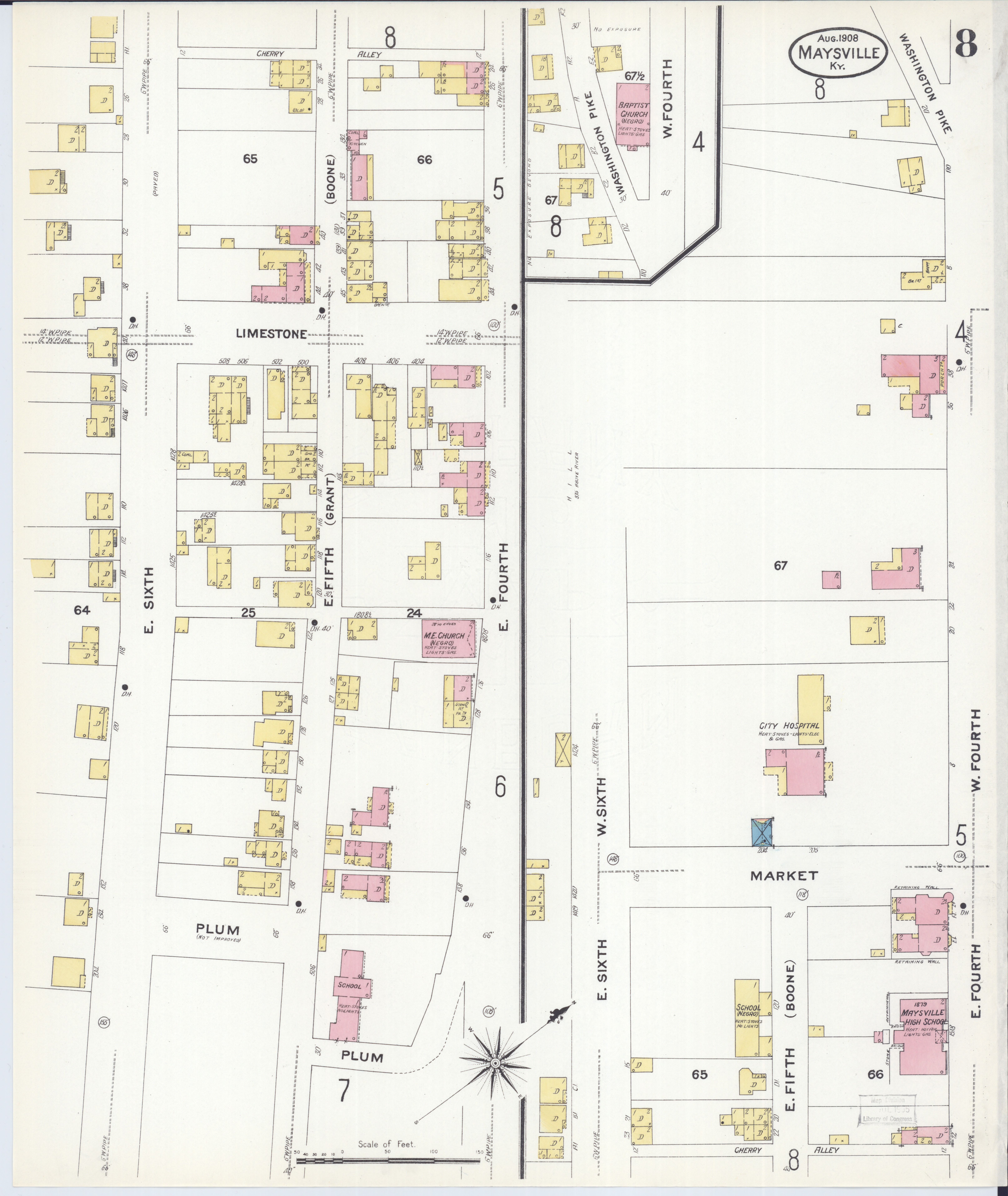
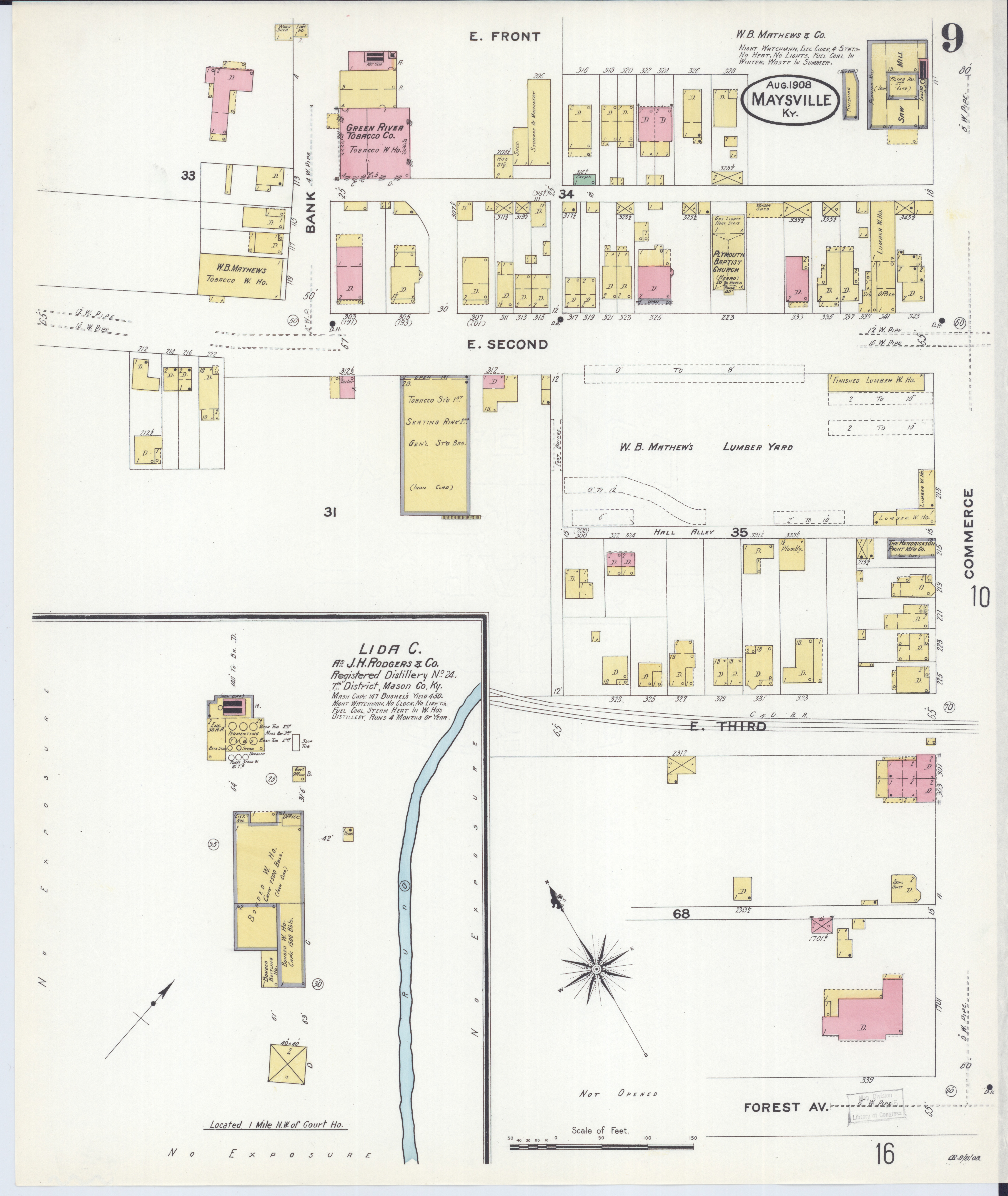

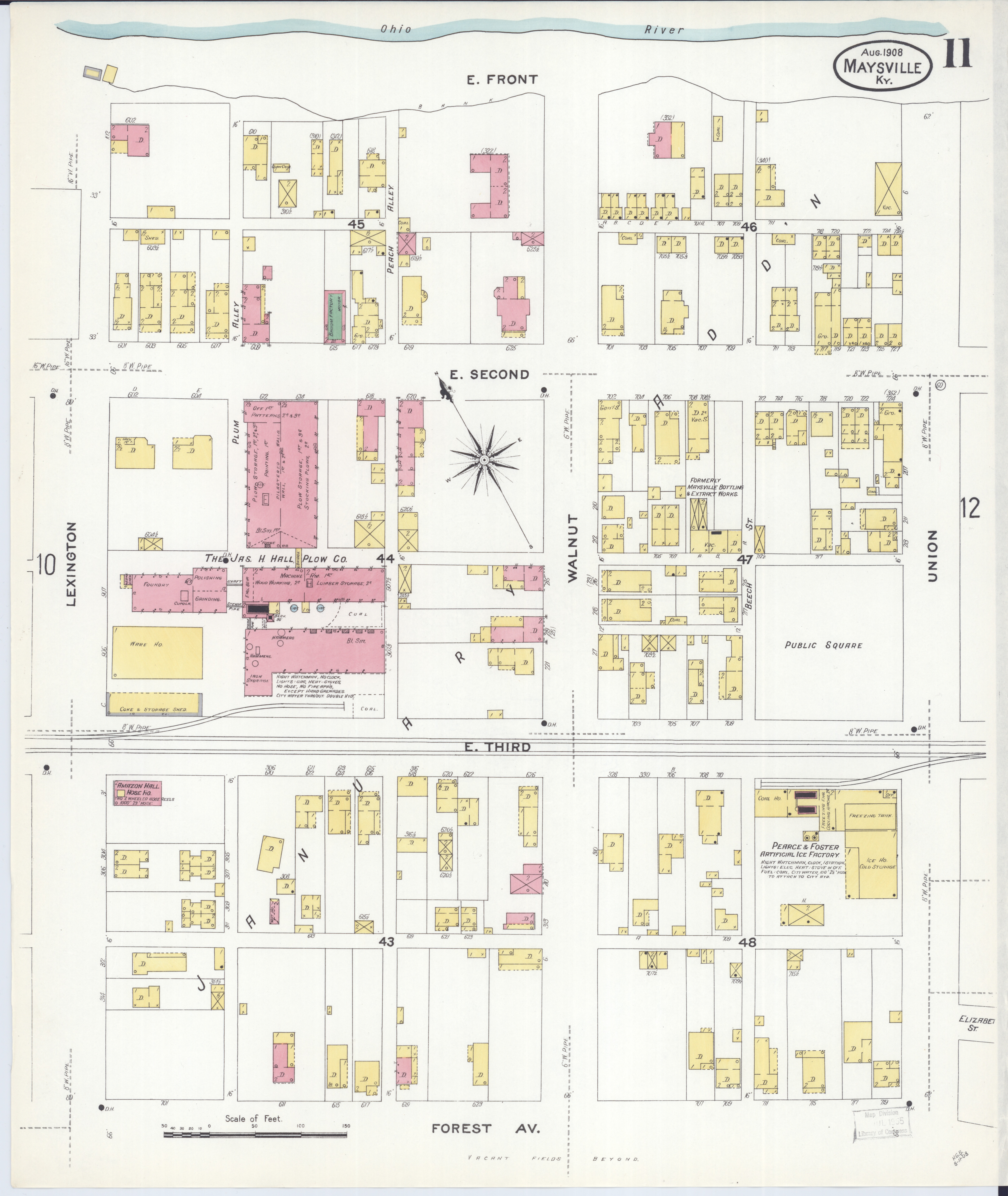
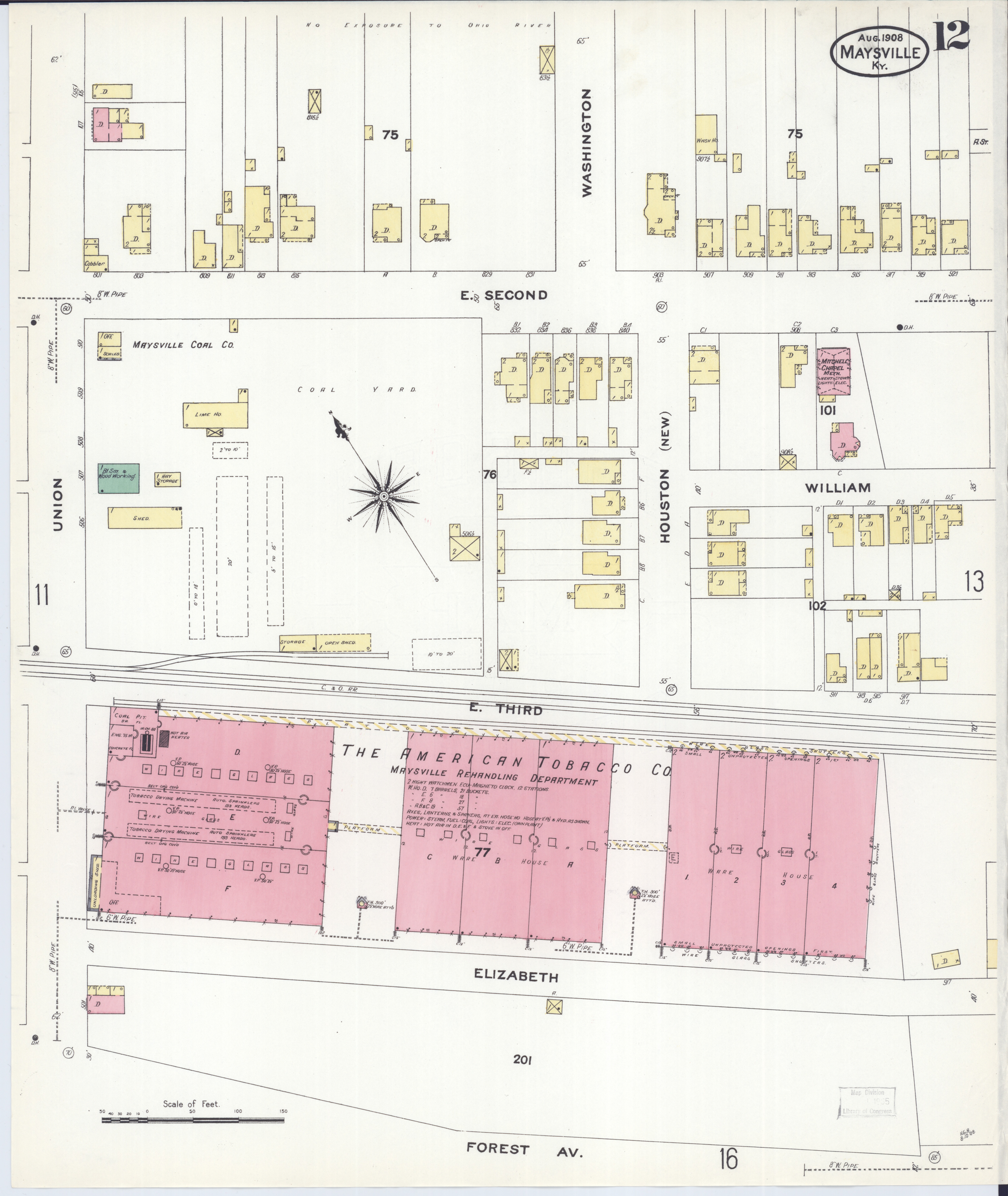
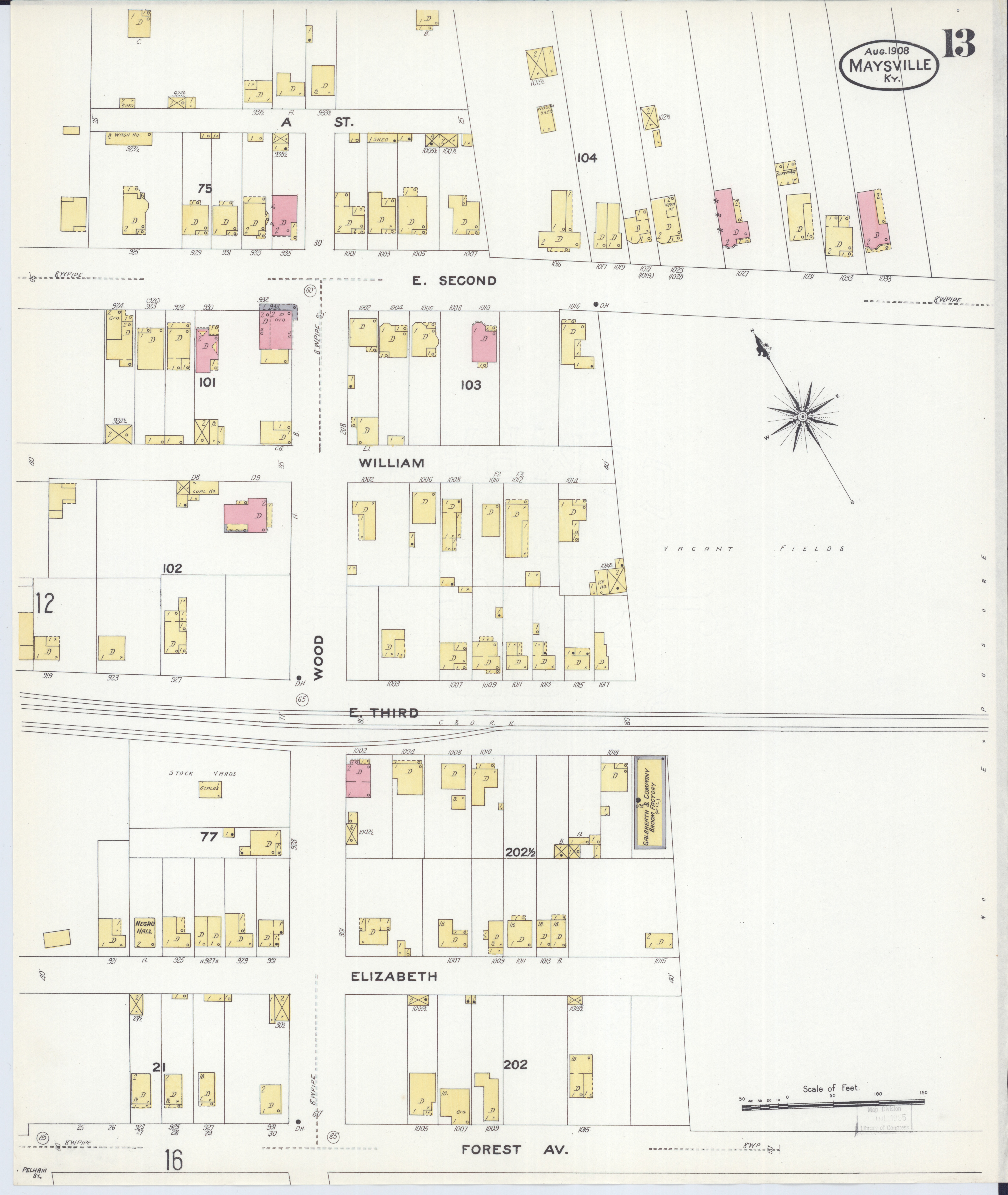
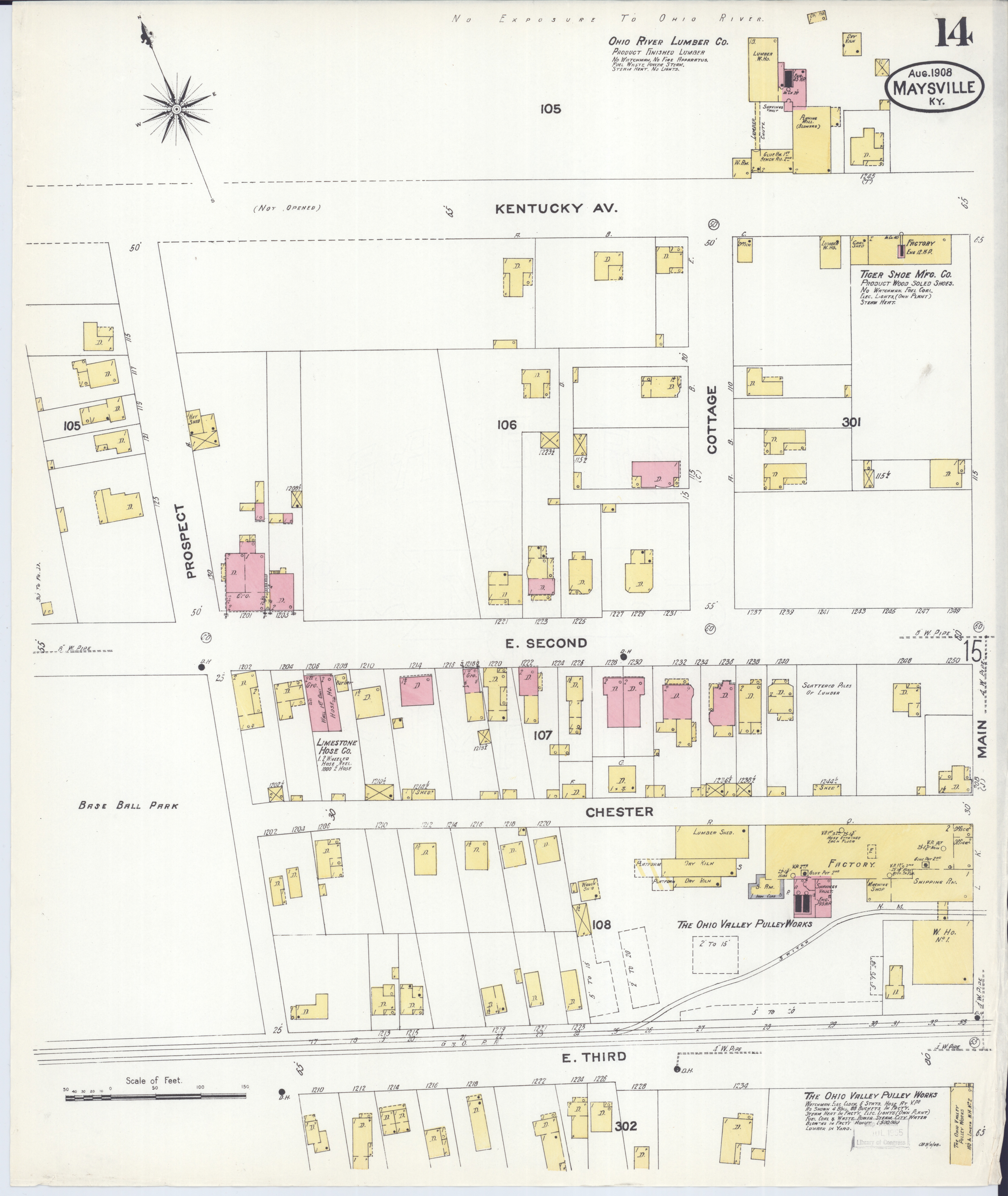

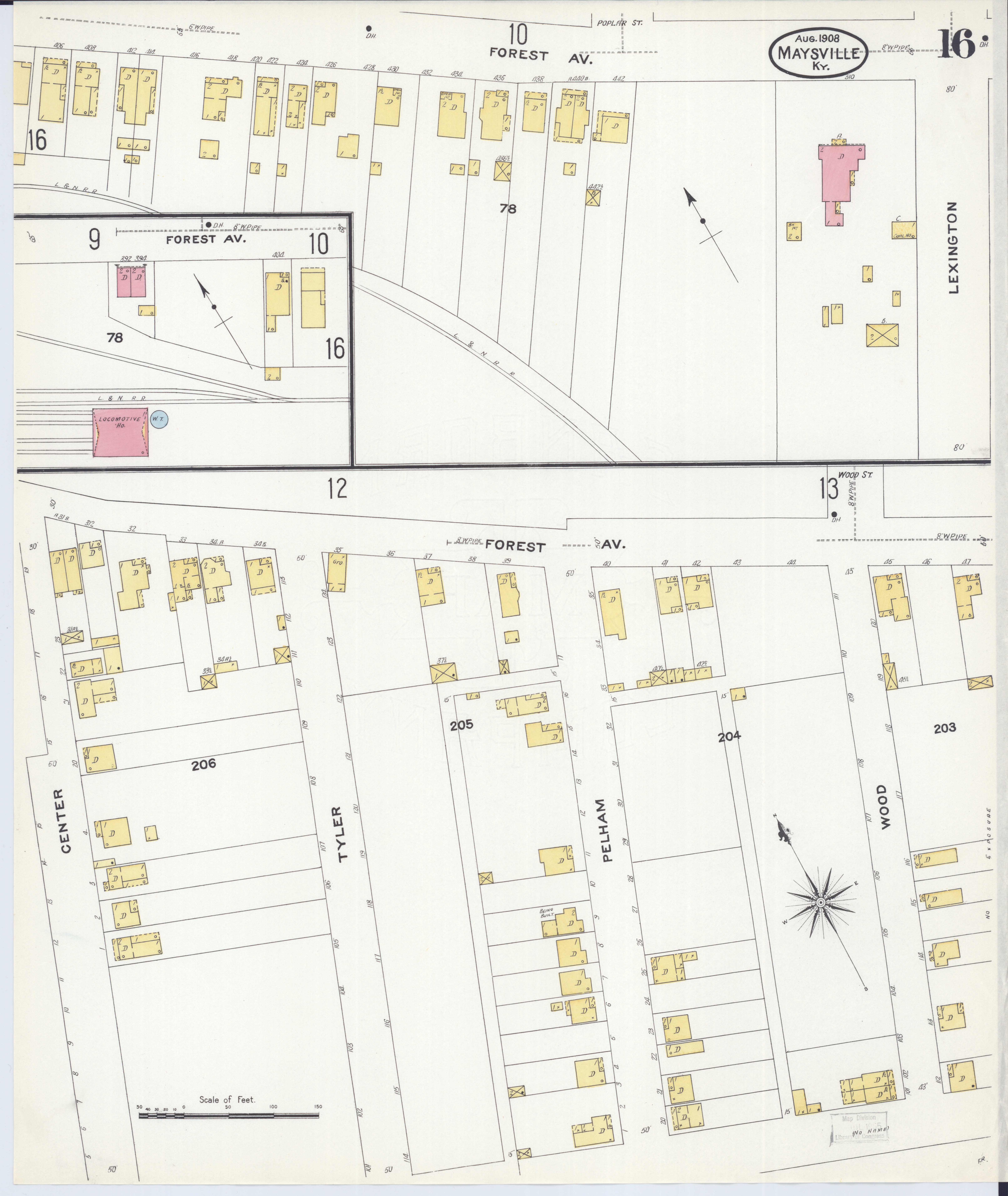

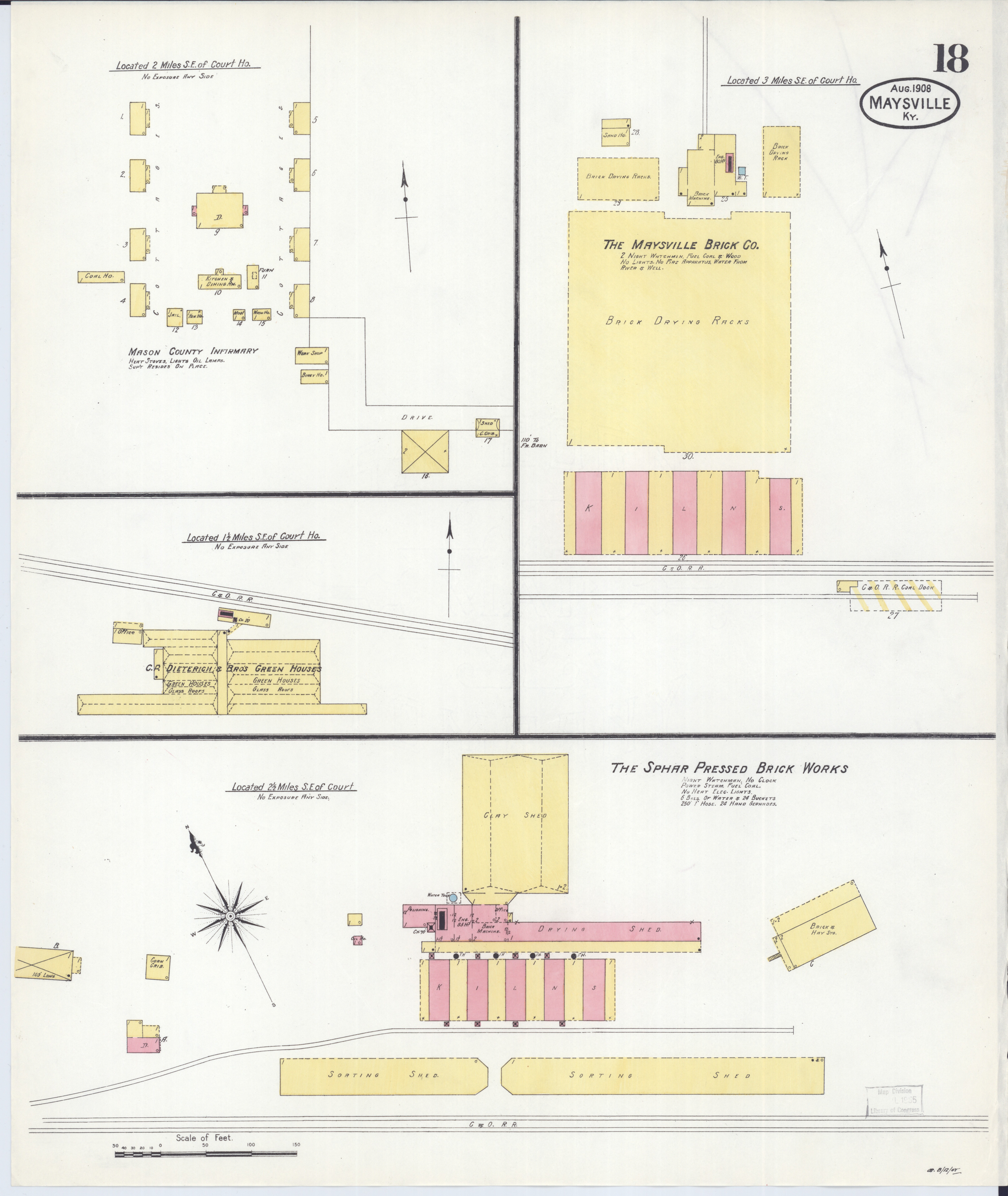
Sanborn maps are detailed maps of U.S. cities and towns in the 19th and 20th centuries